“We couldn't be happier with a promo video she shot for us! She made it so much fun, can't wait to do another!!!!”
S
Snow Dogs Food Truck
Recommends CS MEDIA, LLC
Drone, photo & listing video for Hodgenville, KY listings
CS Media provides real estate photography and drone video for agents and property owners in Hodgenville and LaRue County. Best known as the birthplace of Abraham Lincoln, Hodgenville is a small Kentucky town where most listings are residential homes, farmland, and rural acreage. Properties here often need aerial photography to do them justice. The land is part of the story.
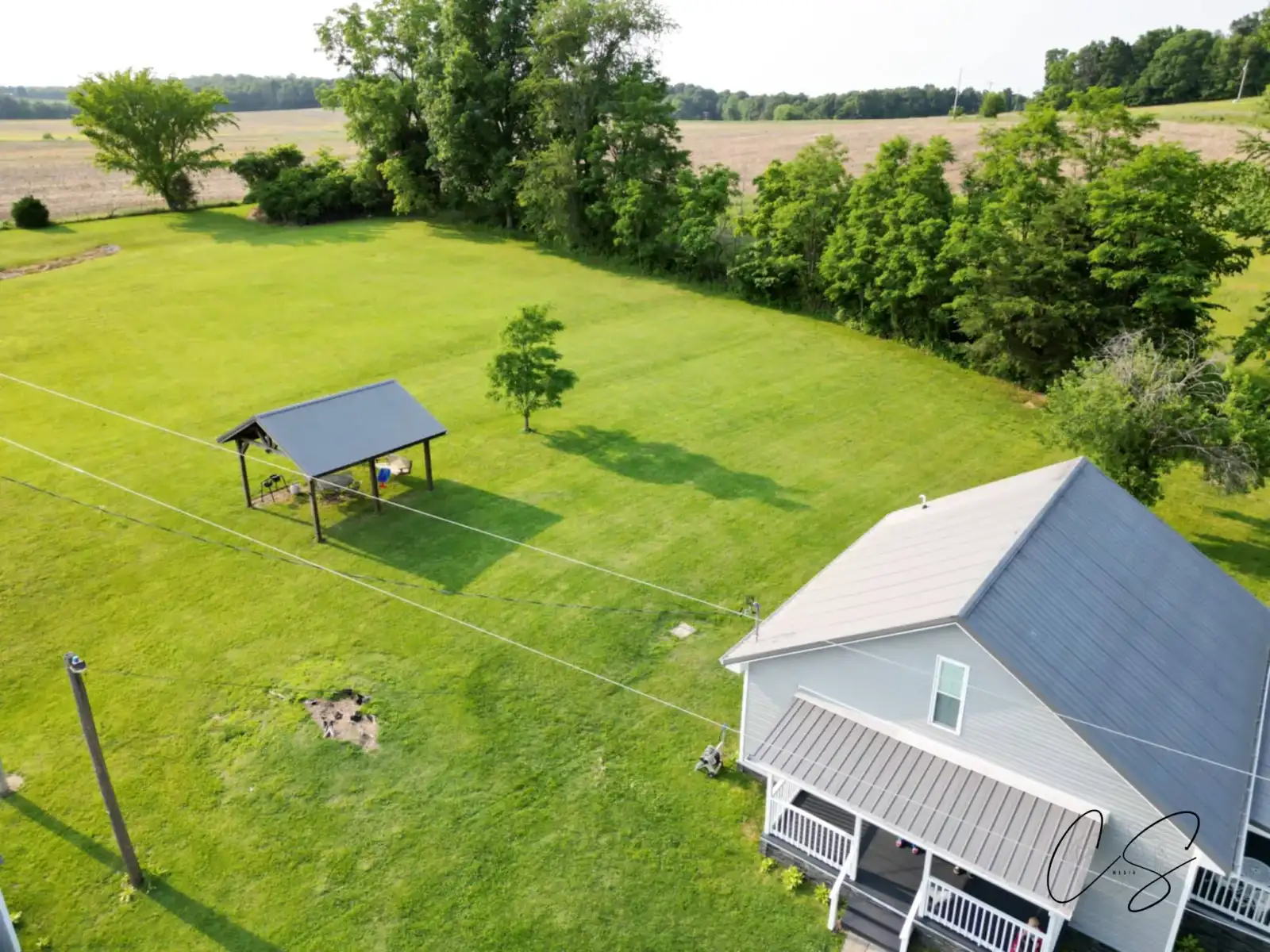
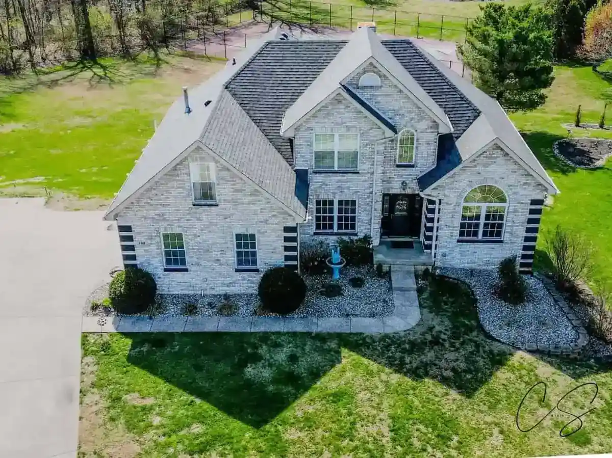
Hodgenville's market is steady rather than fast-moving. Most buyers are local or relocating from nearby Hardin and Nelson counties, looking for rural living within commuting distance of Elizabethtown or Bardstown. Farms, hobby acreage, and country homes are the heart of LaRue County listings, and these are exactly the property types where drone photography makes the biggest difference. A 5-acre property looks the same as a 50-acre property in ground-level photos. From the air, the difference is obvious.
Most photographers serving LaRue County are based in Louisville or Lexington and treat Hodgenville as a side trip. We're 45 minutes away and treat it as part of our home territory. That means competitive pricing, fast scheduling, and someone who actually understands what rural Kentucky listings need to communicate.
FAA Part 107
Certified & insured for every flight
24-48hr Turnaround
Edited files delivered fast
~45 min from base
Serving Hodgenville & LaRue County
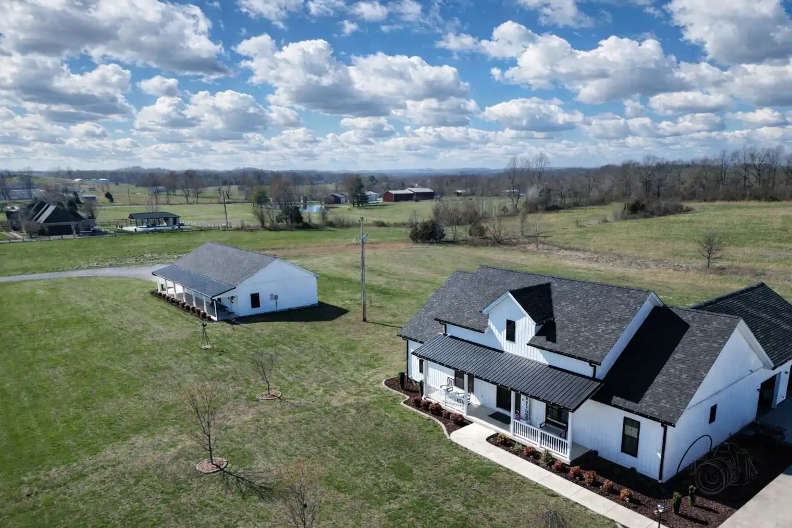
Aerial photography is essential for the kind of properties that dominate the LaRue County market. Our drone shots show acreage, fence lines, woods, ponds, and the relationship between the house and the surrounding land. For Lincoln Heritage Trail tourism properties, drone footage captures the rolling Kentucky countryside that draws visitors here.
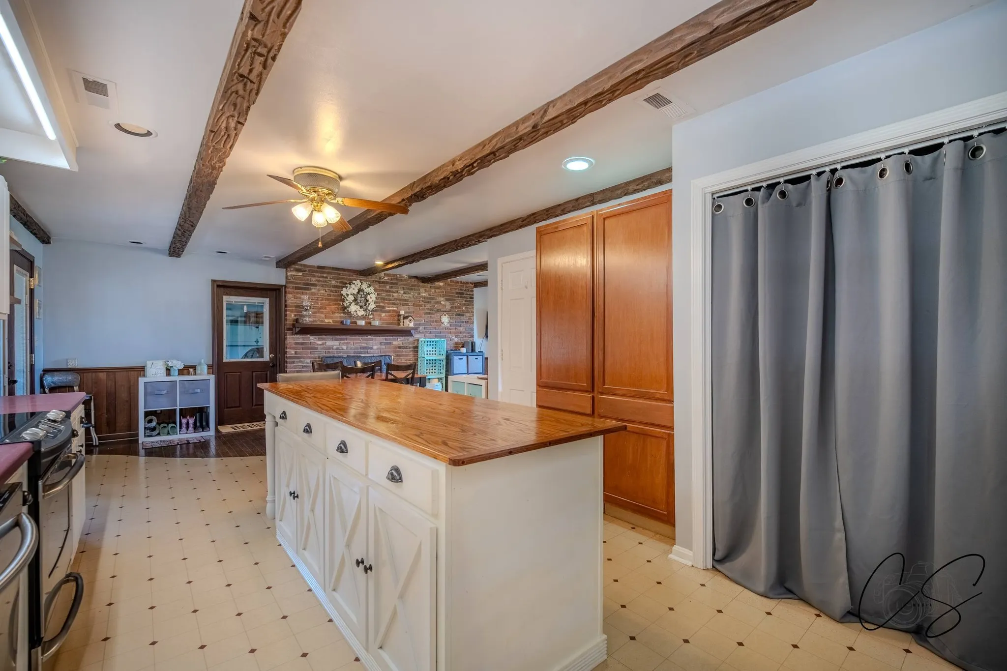
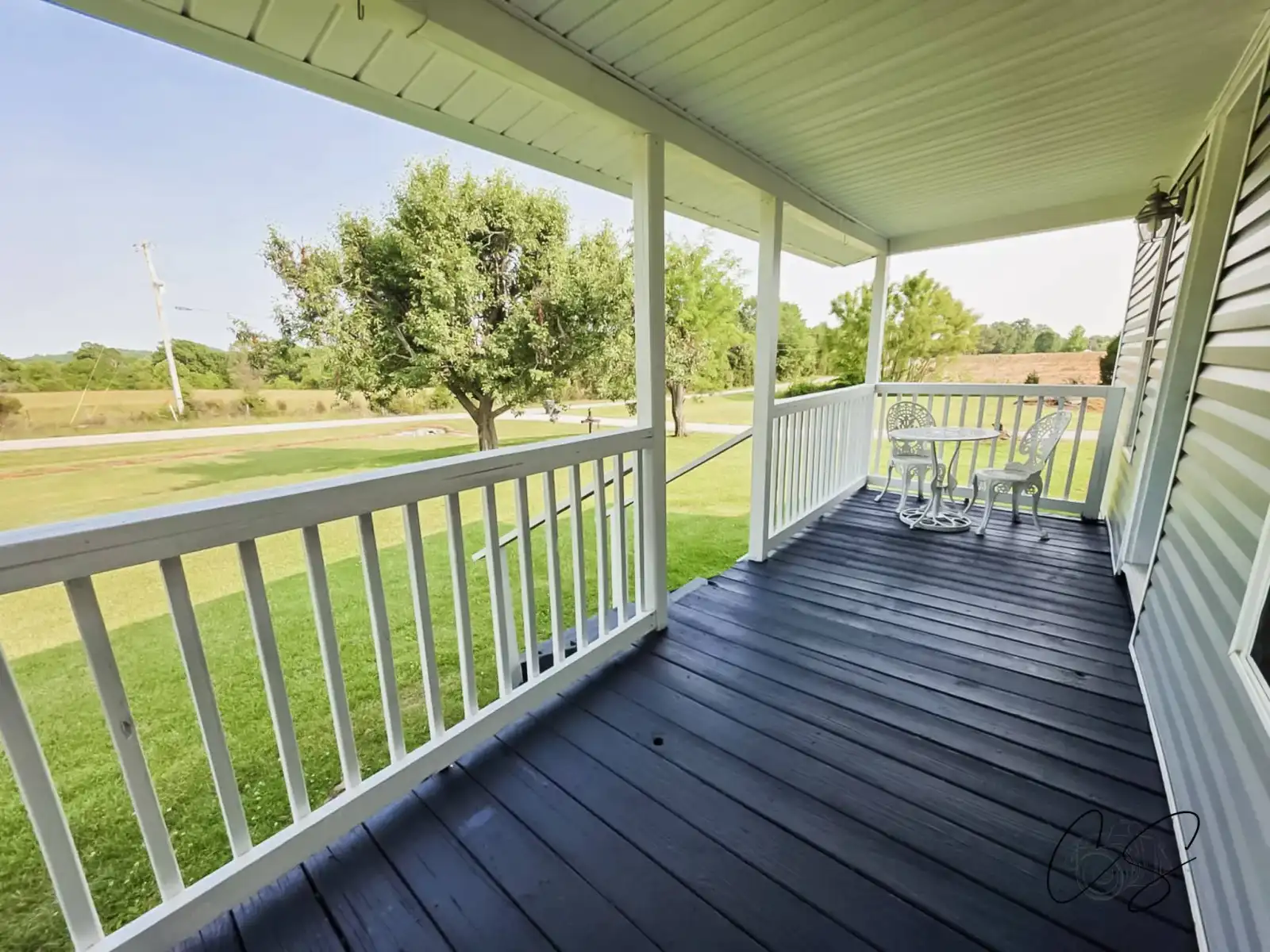
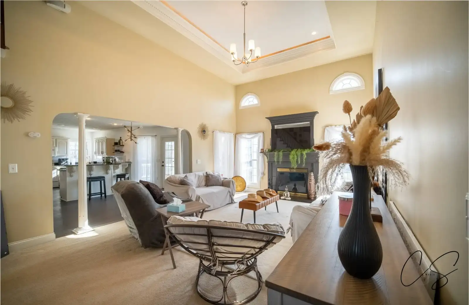
Bright, clean MLS-ready interior and exterior real estate photos for Hodgenville and LaRue County listings. Every shoot includes professional HDR editing and color correction. Delivered in 24-48 hours.
FAA Part 107 certified aerial real estate photography in Hodgenville, KY. Drone shots are included on every applicable shoot, not billed as a separate add-on. Aerial coverage shows lot context, acreage, and surroundings.
30-90 second cinematic walkthrough videos for Hodgenville real estate listings. Optimized for MLS, agent websites, and social media. Buyers tour the property before they ever schedule a showing.
Empty rooms digitally furnished with realistic furniture and decor. A fraction of the cost of physical staging, available as a $25/photo add-on for any Hodgenville or LaRue County listing.
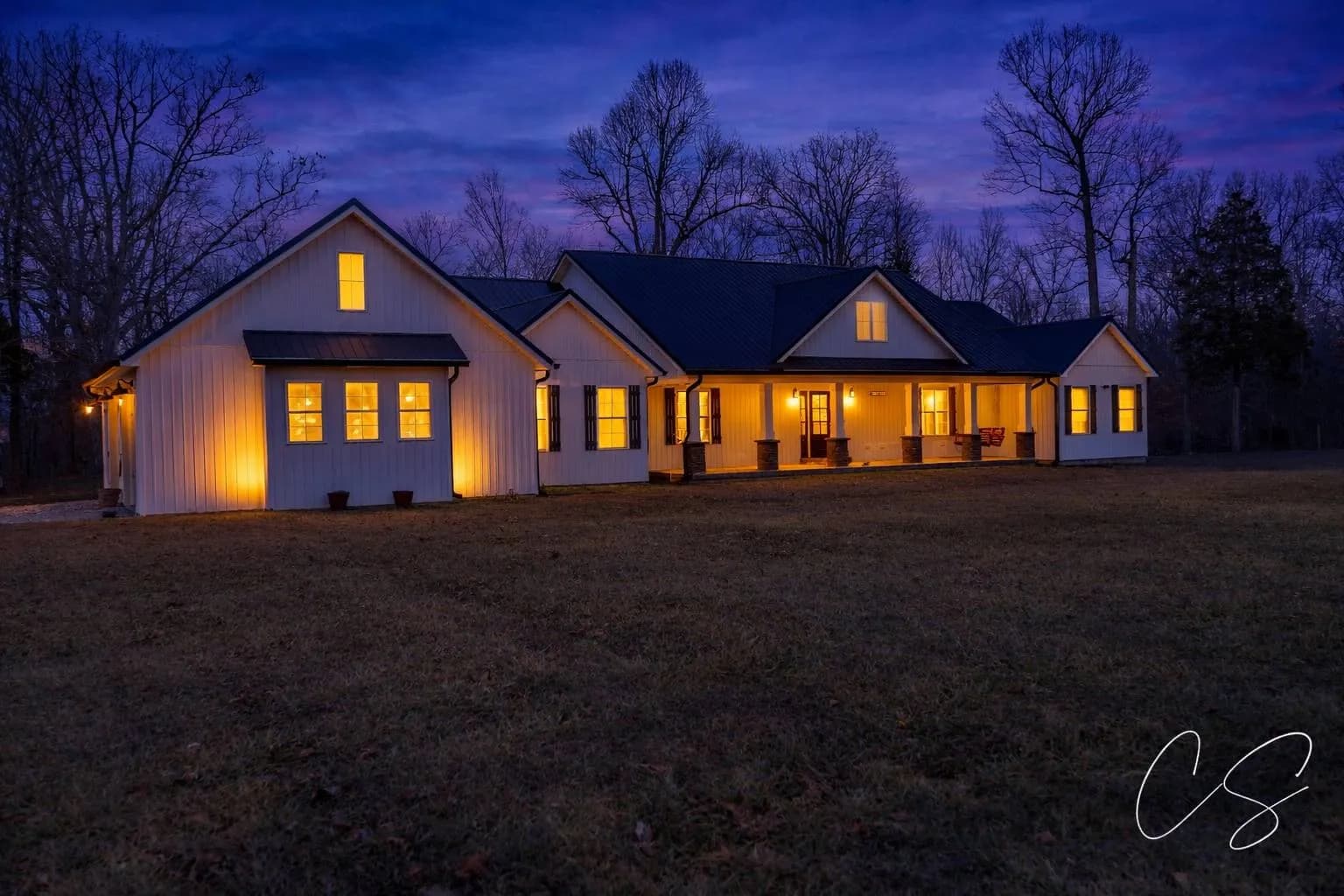
Premium twilight-edit treatment of exterior and aerial shots that turn daytime photos into golden-hour dramatics that stop the scroll. Available as a $25/photo add-on for any package.
Swipe for more →
Rural property listings in LaRue County often underperform because they're photographed like in-town houses: close-up exteriors, backyard shots from the patio, no sense of scale. The whole reason someone is buying acreage is the acreage itself. If your photos don't make it the star, you're underselling the property. Even a single drone shot of total land area can change how a listing feels online.
6% sales tax and 2-way mileage applied to final pricing.
Mileage is determined by Google Maps distance for round trip from Leitchfield.
Just need drone? Aerial Only · $85
Want to see how this compares to the rest of the Kentucky market? Read our full pricing guide
View all packages & add-ons →Yes. Farm and rural acreage listings are some of the most common shoots we do. Our drone equipment captures the full scope of large properties in a way ground-level photos simply can't match.
About 45 minutes via the Western Kentucky Parkway and US-31E. We shoot in LaRue County regularly and can batch with nearby Elizabethtown or Bardstown shoots to reduce mileage.
Yes. Hodgenville and most of LaRue County are in uncontrolled (Class G) airspace with no FAA restrictions. Drone flights for real estate are routine here.
Yes. Tourism-focused properties along the Lincoln Heritage Trail benefit from professional photography that captures both the property and its rural Kentucky setting. We tailor the shoot to the audience the property is marketed to.
Land-heavy listings are exactly where drone photography is most valuable. We can do an aerial-only package starting at $85 if there's no structure to photograph, or include extensive aerial coverage in any package if there's a home plus significant acreage.
“We couldn't be happier with a promo video she shot for us! She made it so much fun, can't wait to do another!!!!”
Snow Dogs Food Truck
Recommends CS MEDIA, LLC
“OH MY GOSH!!!! I can't even say how amazing she is. She designed my watermark and logo and did absolutely AMAZING!!!!! I 100% recommend her for any design needs you may have.”
Jared Clouse - Bary
Recommends CS MEDIA, LLC
Headquartered in Leitchfield and on the road most weeks, CS Media works with real estate agents, Airbnb hosts, property managers, and private sellers throughout Hodgenville and surrounding LaRue County. Our regular shoot routes cover Hardin, Grayson, Warren, Daviess, Nelson, LaRue, Hart, Breckinridge, Meade, and Bullitt counties: central and western Kentucky's main real estate corridors.
We serve LaRue County, including: Hodgenville, Buffalo, Magnolia, Mount Sherman, Athertonville, Tonieville, Upton, Sonora, New Haven, Howardstown, Elizabethtown.
Leitchfield Real Estate Photography · Elizabethtown Real Estate Photography · Bowling Green Real Estate Photography · Owensboro Real Estate Photography · Bardstown Real Estate Photography · Radcliff Real Estate Photography · Hardinsburg Real Estate Photography · Brandenburg Real Estate Photography · Shepherdsville Real Estate Photography · Caneyville Real Estate Photography · Munfordville Real Estate Photography
Whether you're listing a Hodgenville residential property, a LaRue County farm, or a tourism-related rental, we can help. Packages start at $85 plus 2-way mileage from Leitchfield.
Request a Quote